Stratification units are created from the spatial intersection of raster layers representing different sets of classification units. Each set of classification units is related to a particular landscape factor (e.g., topography, climate) or to a particular spatial scale for a single landscape factor (e.g., micro-climate, macro-topography). Each resulting stratification unit is considered to represent a distinct landscape configuration in terms of multiple landscape factors/factor scales (represented by the classification units). This function automatically assigns a unique numeric code to each stratification unit. For x stratification unit, the numeric code represents the unique combination of classification units whose spatial intersection resulted in x. See Examples to get a better idea of the logic behind the code assignment process.
Arguments
- cu.rast
SpatRaster, as in
rast. Multi-layer SpatRaster for which each layer represents a set of classification units for a particular landscape factor or factor scale. Integer cell values (i.e., numeric identifiers) are expected.- to.disk
Boolean. Write the resulting raster layer of stratification units to disk? Default: FALSE
- outdir
Character. If to.disk = TRUE, string specifying the path for the output raster layer of stratification units. Default: "."
- su.name
Character. If to.disk = TRUE, file name (including extension) for the output raster layer of stratification units.
- ...
Additional arguments as for
writeRaster.
Value
su.rast: Single-layer SpatRaster representing the stratification units occurring across geographic space. The cell values in this raster layer represents the numeric codes of stratification units.
code.mult: Multipliers used for the creation of the numeric codes. See Details.
Details
When printing su.rast$code.mult, the output shows the multiplier used for each landscape factor/factor scale. From this output, one can manually replicate the creation of stratification units through simple raster algebra. To do so, a weighted sum of the SpatRasters containing the classification units for each landscape factor/factor scale should be performed using the multipliers as weights. Note that the weights do not imply relative importance. The weights are required only to preserve a logical structure of the landscape factors/factor scales in the resulting numeric code.
Examples
require(terra)
p <- system.file("exdat", package = "rassta")
# Multi-layer SpatRast with classification units (Cus)
## Three sets (i.e., landscape factors): geology, climate and topography
fcu <- list.files(path = p,
pattern = "geology.tif|climate.tif|topography.tif",
full.names = TRUE
)
cu <- terra::rast(fcu)
# Stratification units (SUs)
su <- strata(cu.rast = cu)
# Plot the stratification units
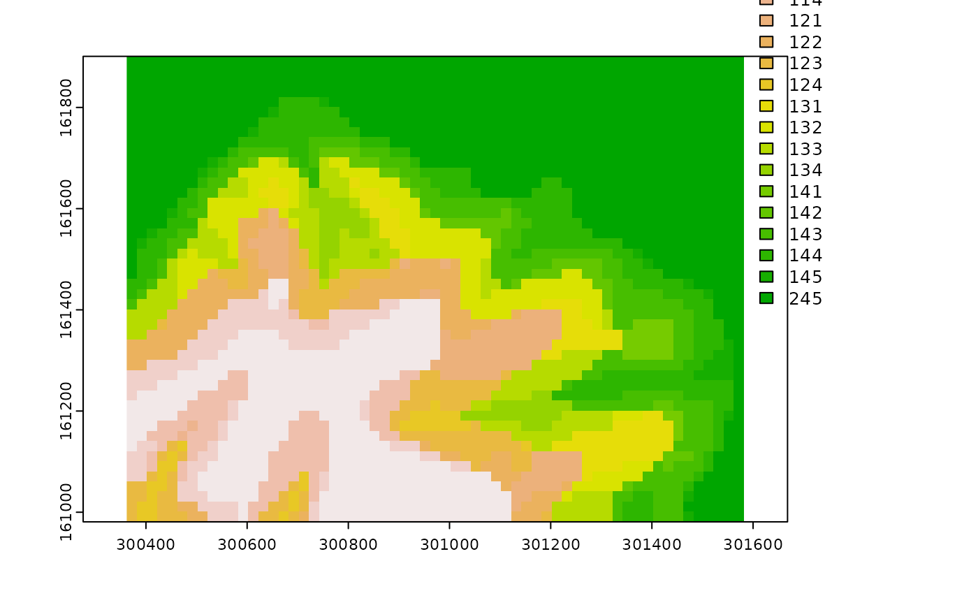
if(interactive()){plot(su$su.rast, type = "classes")}
 #
# Note code structure from SUs and corresponding values from CUs
z <- c(su$su.rast, cu)[46,61] # Example of one cell (row = 45, column = 45)
su$code.mult # Multipliers
#> geology climate topography
#> 100 10 1
z[c("SU", names(su$code.mult))] # Code structure
#> SU geology climate topography
#> 1 245 2 4 5
# Note what happens when some landscape factors have cell values greater...
#... than 1 digit (i.e., more than 9 distinct classification units)
cu <- c(cu[[1]], cu[[2]]^4, cu[[3]]^2)
su <- strata(cu.rast = cu)
su$code.mult
#> climate geology topography
#> 10000 100 1
c(su$su.rast, cu[[names(su$code.mult)]])[46,61]
#> SU climate geology topography
#> 1 41625 4 16 25
#
# Note code structure from SUs and corresponding values from CUs
z <- c(su$su.rast, cu)[46,61] # Example of one cell (row = 45, column = 45)
su$code.mult # Multipliers
#> geology climate topography
#> 100 10 1
z[c("SU", names(su$code.mult))] # Code structure
#> SU geology climate topography
#> 1 245 2 4 5
# Note what happens when some landscape factors have cell values greater...
#... than 1 digit (i.e., more than 9 distinct classification units)
cu <- c(cu[[1]], cu[[2]]^4, cu[[3]]^2)
su <- strata(cu.rast = cu)
su$code.mult
#> climate geology topography
#> 10000 100 1
c(su$su.rast, cu[[names(su$code.mult)]])[46,61]
#> SU climate geology topography
#> 1 41625 4 16 25